Developing a Geopark’s visibility
a case study provided by Armorique Aspiring Geopark, France
The public visibility of Armorique Aspiring Geopark is centred upon three linchpins:
- The Communications Strategy which is highlighted in “Axis 5” of the Armorique Geopark Management Plan:
- The Armorique Aspiring Geopark signposting plan
- The in situ and external interpretation of the Armorique Geopark
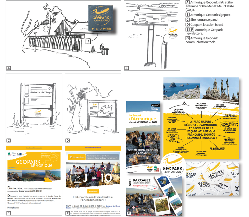
The work necessary to improve the visibility on the ground around the Aspiring Geopark has been the subject of a signposting plan that focused on the labelling of tourist geosites and the tools required for initial development. The first phase of marking has been deployed on key sites around the Geopark:
- the laying of slabs engraved with “Armorique Geopark”. These use local stone, the involvement of local craftsmen for their making, and a low profile to not interfere with the landscape;
- the installation of signposts, close to the educational panels already set up by the Geopark or its partners;
- the installation of site-entrance panels using already existing stands;
- the establishment of a dedicated space in the Menez Meur Estate (Geopark Visitor Centre) and educational panels in the Geopark.
This work has been complemented by the installation of location map panels, positioned at the entrance of the main geographical areas of the Geopark territory. They include general information about the Geopark and a map showing distribution and location of geosites.
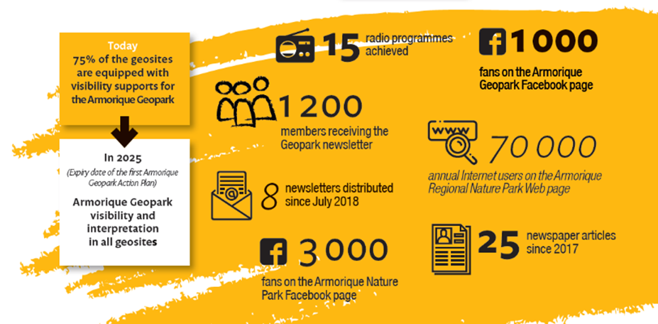
The Armorique Geopark has an attractive general public leaflet and a tourist map of the territory. Digital tools (the Armorique Geopark Web page, newsletter and social media) as well as articles in newspapers complete the methods by which information about the Geopark is distributed to the public.
The availability of displays at the various the Tourist Information Centres and partner organisation facilities and infrastructure also plays a major role in the visibility strategy of the Armorique Geopark.
Another part of this strategy relies on the utilisation of the Geopark publicity and branding style template by the local Geopark partners, as can be seen from the picturesque geosite of the Forest and Granitic Boulder Field of Huelgoat. In this example, the Geopark graphic style guidelines have been used effectively by the project holders to integrate them in the interpretation project of the site. This has led to an increased visibility of the Geopark on the 11 sites of geological and archaeological interest in Huelgoat which additionally presents information tri-lingually – in Breton, French and English, further promoting local culture and language to tourists.